The AQMO mobile sensor plateform
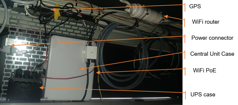
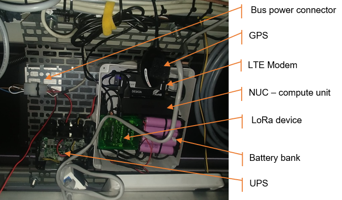
The mobile sensor platform is meant to collect, process locally and transmit data. This platform includes the central unit below, as well as a camera and sensors.
The camera collects data such as the number of vehicles in front of the bus, etc.
The images are erased as and when. Blurred control images are retained during the debugging phase.
Sensors & measurements
There are two major issues when measuring pollution:
- The quality of measurements
- The spatial and temporal coverage of measurements
REGULATORY ASPECT
“Air Breizh, a non-profit type association, is the organization approved by the Ministry of the Environment for the monitoring of air quality in Bretagne.” As an observatory of the quality of the air in Bretagne, its missions are: Measure and anticipate, Inform, study and raise awareness.
The Air Breizh network comprises 19 measurement stations (8 of which are in Rennes Métropole) to meet current regulations: measurements of particulate matter (PM2.5 and PM10), nitrogen oxides, ozone, benzene, PAH and heavy metals…
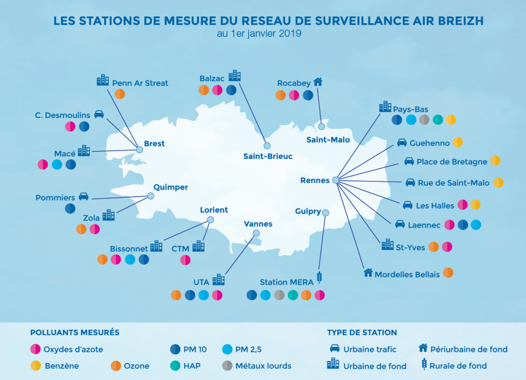
The reference measurements are carried out using expensive (tens of thousands of euros) scientific instruments, voluminous and imposed by the Ministry of Ecological and Solidary Transition (tests, controls and approvals issued by the LCSQA Central Laboratory of Surveillance of the Air quality).
Air Breizh establishes a spatial and temporal inventory of emissions of pollutants in Bretagne.
Air Breizh also performs modelling to supplement spatial and temporal knowledge of pollutant concentration measurements in the region.
RESEARCH AND EXPERIMENTATION ASPECT
There are also low-cost sensors (a few tens of euros, SDSO11) but with significant uncertainties about the measurements (often mono-pollutant and sometimes not very robust).
In the context of AQMO, these sensors have two functions: they make it possible on the one hand to reduce the cost of setting up the prototype, but also, once the platform is operational, to usefully complement the measurements from the reference sensors, in particular by allowing to integrate these sensors in the AQMO mobile platform.
Spatial and temporal coverage is achieved by integrating mobile sensors by taking advantage of the metropolitan bus network.
The other issue is the transmission of measures. AQMO currently uses three types of networks: Wifi, GSM and LoRa.
The contextualization of the measures aims to understand why certain measurement values are obtained. For example, is the bus with the sensors jammed behind another vehicle or is it a local pollution problem. We have two contextualization data:
- GPS coordinates
- Analysis by an AI engine of the environment in front of the bus (number of vehicles, pedestrians, etc.)
All of this data is anonymous.